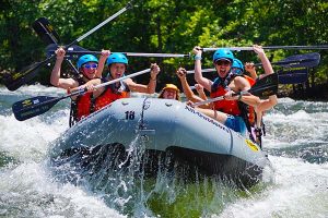
Predicting California River Flows for Rafting
Understanding and predicting California river flows is a critical part of planning a successful whitewater rafting season. For us, this process began more than 60 years ago and has evolved alongside advances in hydrology, weather forecasting, and public data access.
How Snowpack and Rainfall Control California Rivers
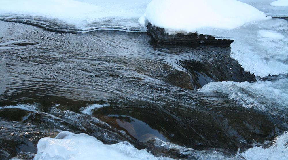
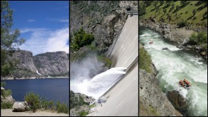
All California rivers are ultimately fed by rain and snow, especially precipitation that falls in the Sierra Nevada during the winter “wet season,” which typically runs from October through April. Snowpack acts as natural water storage, slowly releasing meltwater into rivers as temperatures rise in spring and early summer.
To understand how rivers will behave during the The 4 “Seasons” of the California Rafting Season, it is essential to understand what happened at higher elevations during the winter months. Simply put: what falls in the mountains determines what flows downstream.
Early Methods of Tracking River Conditions
Our interest in river flows dates back to our first rafting trip on the Stanislaus River in 1962. That experience sparked a lifelong focus on rivers – and on understanding how winter conditions shape the rafting season ahead.
In the early years, our methods were simple. We observed rainfall patterns at our home in Walnut Creek and tracked snow depth at our family cabin in the Sierra. These informal observations formed our earliest attempts at predicting river flows.
Advancing from Observation to Data Analysis
Over time, our approach became more refined. We built relationships with experts at the California Department of Water Resources in Sacramento, who helped us learn how to interpret rainfall totals, snowpack reports, and reservoir storage levels. This education allowed us to move from basic observation to informed analysis.
With the birth of the internet and the growth of online public reporting tools, access to hydrologic information expanded dramatically. Today, we rely on a combination of real-time data sources and our 60+ years of firsthand river experience to estimate how California rivers will run during each rafting season.
Winter: Monitoring a Constantly Changing System
Predicting river flows is a dynamic process, and no two winters are ever the same. While California’s wet season spans October through April, not all months contribute equally to snowpack and runoff.
- October and November are often warmer, with precipitation falling as rain rather than snow
- December through March typically have the greatest impact on snow accumulation
- April storms can help, but often play a smaller role in total seasonal snowpack
Over the years, we have seen every possible scenario: early atmospheric rivers followed by dry stretches, slow starts with strong late-season storms, and everything in between. Because of this variability, meaningful predictions usually do not become clear until late March.
Creating Spring River Flow Forecasts
As winter transitions into spring, we compile the season’s rainfall totals, snowpack measurements, and reservoir data. We then compare these patterns to more than six decades of past rafting seasons, looking for similarities that help guide our expectations.
Using this historical comparison, we develop river-by-river flow predictions for each of the 10 California rivers we operate on. These forecasts help both our team and our guests plan trips with a clearer understanding of what conditions are likely to look like.
Each spring, we publish a summary of these predictions on our River Flows page. This page includes real-time river flow graphs and is updated regularly throughout the rafting season as conditions evolve.
Accuracy Through Experience and Data
While river forecasting is never exact, combining long-term experience with modern data sources has allowed us to produce consistently reliable predictions. These forecasts help ensure that guests can plan ahead and enjoy some of the best rafting rivers in California at the right time of year.
Snowpack and Weather Resources We Use Today
Below are some of the primary resources we rely on each winter when evaluating how long, how well, and how consistently California rivers will run during the rafting season:
- California Department of Water Resources – Snow Water Equivalent Daily Report
Updated daily during the wet season, this report shows how much water is stored in the statewide snowpack. - California Department of Water Resources – Snow Water Content Chart
Displays snowpack as a percentage of the April 1 average for Northern, Central, and Southern California, with historical comparisons. - National Weather Service – Sierra Nevada Regional Snow Analyses
Interactive maps and historical data showing snow accumulation and melt patterns across the Sierra Nevada. - California Department of Water Resources
Provides timely updates on monthly snow surveys and statewide water conditions. - UC Berkeley Central Sierra Snow Lab
Shares detailed observations and insights from a high-elevation research facility near Donner Summit. - National Weather Service Sacramento
A reliable source for regional weather forecasts, storm tracking, and snowpack information affecting the Central Sierra region.
Keep Reading – There Is More to Explore:

Gregg Armstrong
Gregg is the middle child of George and Dolores Armstrong’s five children. He has been working with All-Outdoors since it was founded. He guided and set up early operations on California rivers in the 70’s and 80’s before making marketing for AO and reservations his main responsibilities. One of his claims to fame is that he and his wife Marion had triplets, who grew up to enjoy rafting and outdoor activities as much as he does. When not doing AO and family life he loves to ski, garden, and spend time with people.